Great Photography Spots In Vermillion Cliffs National Monument
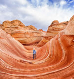
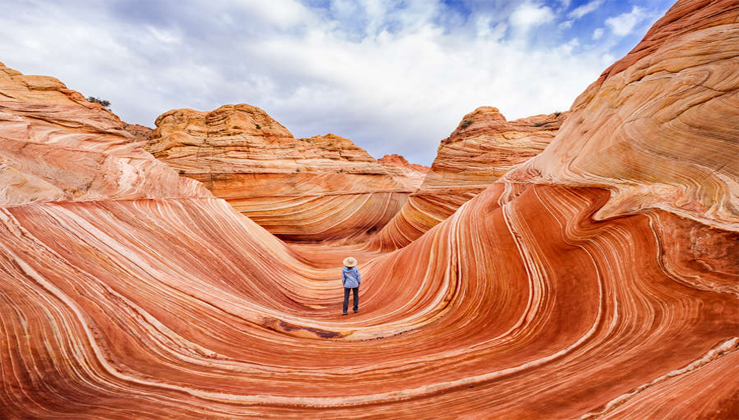
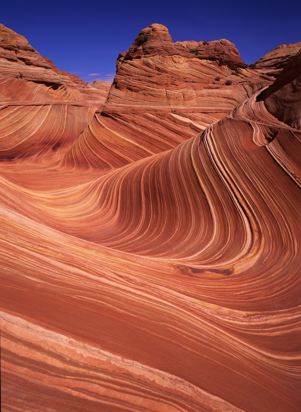
Fantastic lunar landscape of the Wave, in the Vermillion Cliffs National Monument, located in both Utah and Arizona. Story & Photography by Jerry Ginsberg. Although the four states that comprise the great Southwest (New Mexico, Arizona, Colorado and Utah) contain a combined total of thirteen national parks, this vast area has so much spectacular natural beauty that all of it could not possibly be contained within these parks.
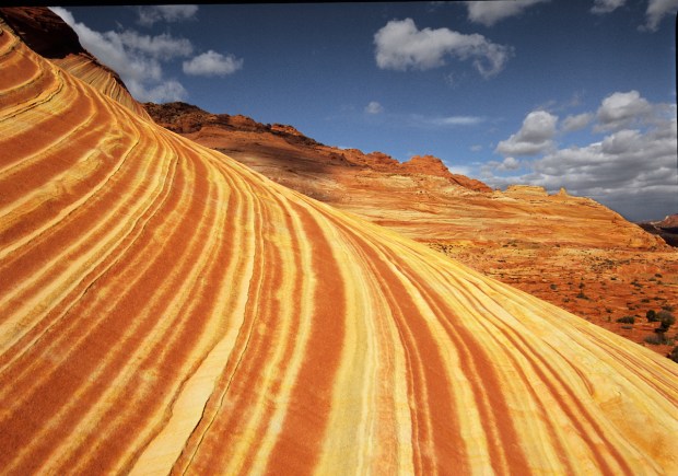
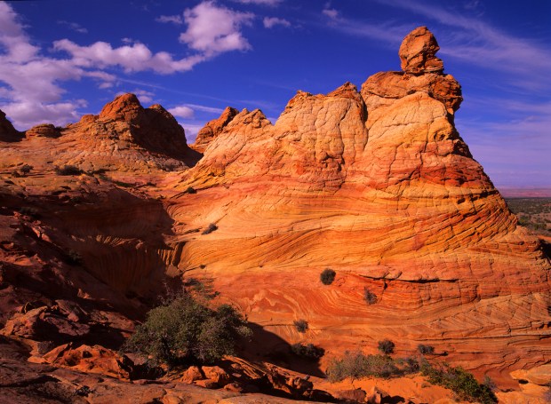
Fortunately, a great deal of the precious wilderness lying outside the defined borders of these national parks has been protected as well. In most cases, these are federal lands; in several others, state parks. Standing high among these is the Vermillion Cliffs National Monument. Including the former Paria Wilderness, this 294,000 acre tract on the very northern edge of Arizona* is bigger than several of our actual national parks. In addition to the great, but lengthy hike through Paria Canyon, perhaps the very best area of this national monument begins at the head of the Wirepass Trail. This is the starting point for two distinctly separate hikes featuring markedly different types of great photography. Striations: Such sensuously rounded red rock forms are common in the bowl of the Coyote Buttes.
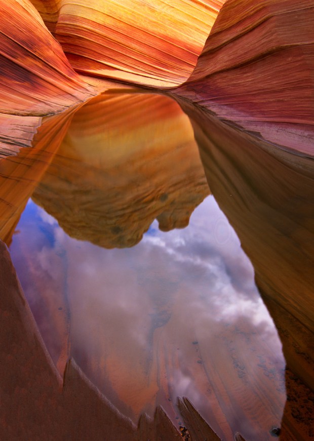
Hiking in the Paria The Wirepass trailhead is reached by driving west from Page, AZ or east from Kanab, UT on Route 89 to House Rock Road. Turn south and go approximately 8-8.5 miles down House Rock Road to the parking area on the right. Walk across the tiny road, go down into the dry wash and turn left. If you stay in the wash until the ‘T’ intersection at a high rock wall and then turn right, you will be going down into famed Buckskin Gulch. This is a wonderful narrow slot canyon which can be prone to flash flooding, so be very careful about checking the weather forecast for any possibility of rain anywhere in the area. For the best photography in a slot canyon such as this, you’ll need a bright, sunny day anyway, so staying away on a cloudy day means that you are not missing out on making good images. Wave Pool Reflection: As you enter the Wave area, this slight depression in the rock is before you. On rare occasions, it can fill with rain water. Carrying in an extra liter will ensure seeing this reflection.
Slot canyon photography Unlike most landscape photography, the best slot canyon shooting is most likely to happen on just such a sunny day when the sun is either directly or close to being positioned just overhead. When the sunlight is streaming through the narrow opening above you and directly striking one wall of the canyon, its warm glow can often reflect onto the opposite wall. It is exactly that reflected (in some cases, re-reflected) light striking the multi-hued rock that provides the best images. Using contrasts of both color and light, varying your compositions can result in a great selection of original and artistic images. As a rule of thumb, the best results are often those that exclude the sky. This iconic form may be the star of the South Coyote Buttes, reached only after a tricky drive requiring four-wheel drive and good clearance.
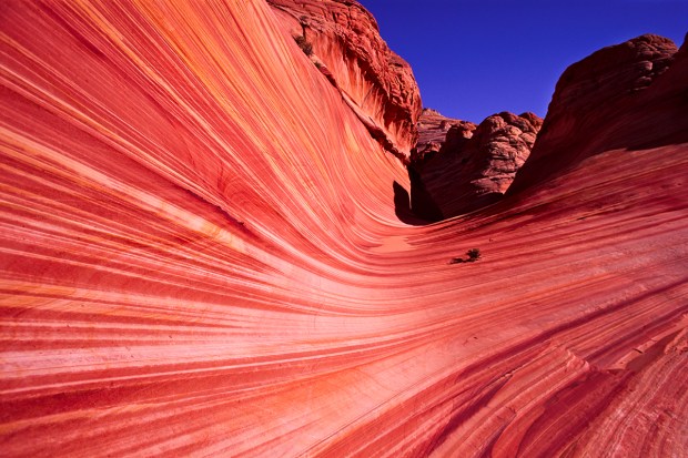
Coyote Buttes The other trail, reached from the very same starting point, will allow you to go to the North Coyote Buttes, home of the iconic Wave. To go into this area, you’ll need a permit from the BLM. These are available in an online lottery 4 to 6 months in advance or on a very limited basis just 1-2 days in advance at the BLM / Interagency ranger station on Route 89 just east of Kanab, Utah. However, simply obtaining a permit won’t actually get you into the Buttes.
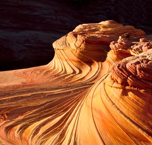
Swirls: This unique swirled sandstone formation sits perhaps 150 yards above the Wave. It is best photographed just before the sun drops below the rock wall to the west. Once the light fades from the rock, it is time to head back to your vehicle. On one hand, you’ll need a variety of wide angle and very short telephoto lenses along with a sturdy tripod to cover the area adequately. A range of about 20 through 100 mm (full frame equivalent) should do it. And make sure to carry at least two liters of water per person. On the other hand, the more gear you carry in, the heavier your pack will be on the way back after a long day, water excepted, of course.
A much less well known spot is the South Coyote Buttes. Visiting here by driving in from the other side can be a bit tricky. The access “road” has some sections of sand and others of bare rock. Getting into the South Buttes will definitely require a muscular vehicle with 4-wheel drive and good clearance. Off road tires will also be helpful. Both the North and South Buttes have remarkable cone shaped forms dubbed “teepees.” When I first found my way into this glorious natural area many years ago, it was largely unknown and virtually pristine. A quarter century and zillions of hikers later, it is sad to see that the fragile sandstone has taken a real beating. Whatever you do, please adopt “Leave no trace” as a heartfelt mantra. Often overlooked, the south portion of the Coyote Buttes features several terrific subjects and compositions.
Lake Powell & Gunsight Butte If you’re looking for another great photo location nearby, Gunsight Butte on the edge of Lake Powell (in the lake if the water level is really high) can be great in the right light and depending upon the lake’s water level. It’s a scene custom-tailored for a panoramic composition. To reach a viewpoint above this singular rock formation, drive north through the tiny hamlet of Big Water, UT and thread your way through the network of unpaved roads past town toward the lakeshore. GPS will be a really big help here. Since the unpaved roads in the locations described above (Coyote Buttes South excepted) are generally well graded and maintained, driving a standard passenger vehicle will likely prove adequate. For a little extra insurance, think about driving a vehicle with some additional clearance, but 4-wheel drive should not be necessary. Entrance to the Wave: Once you reach this inviting spot, just a few more steps will bring you to the bottom of the actual Wave.
The Usual Logistics. Staying in any one of the many motels in Page, AZ or Kanab, UT will be convenient. Both towns cater to tourism and have a wide variety of restaurants and eateries. Kanab is convenient to Zion National Park and is just fine, but my personal preference is Page, since it has several other photo-worthy spots right on the edges of town. While theVermillion Cliffs National Monument is officially located entirely in Arizona, trails may occasionally bring one’s feet across the state line into Utah.
View a short video with stunning scenes from the Vermilion Cliffs area in Northern Arizona.
Jerry Ginsberg is a long-time nature and travel photographer whose landscape and travel images have graced the covers and covers of hundreds of books, magazines and travel catalogs. He is the only person to have photographed each and every one of America’s National Parks with medium format cameras.
His works have been exhibited from coast to coast and have received numerous awards in competition and he has been awarded Artist Residencies in several National Parks.
Jerry’s photographic archive spans virtually all of both North and South America. More of Ginsberg’s images are on display at www.JerryGinsberg.com, or email him at jerry@jerryginsberg.com.






 Photographer Finds Locations Of 1960s Postcards To See How They Look Today, And The Difference Is Unbelievable
  Hij zet 3 IKEA kastjes tegen elkaar aan en maakt dit voor zijn vrouw…Wat een gaaf resultaat!!
  Scientists Discover 512-Year-Old Shark, Which Would Be The Oldest Living Vertebrate On The Planet
  Hus til salg er kun 22 kvadratmeter – men vent til du ser det indvendigt
  Superknepet – så blir snuskiga ugnsformen som ny igen!
  Meteorite That Recently Fell in Somalia Turns Out to Contain Two Minerals Never Before Seen on Earth
  Nearly Frozen Waves Captured On Camera By Nantucket Photographer
  It’s Official: Astronomers Have Discovered another Earth