A towering thunderstorm lights up the night skies over Panama, as seen at 37,000 feet. (Photo by Santiago Borja.)
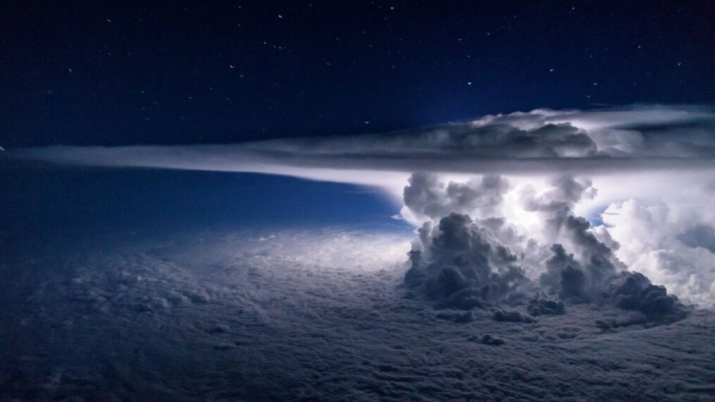
A pilot of a Boeing 767 captured a stunning photograph of a thunderstorm billowing over the Pacific Ocean last month.
First Officer Santiago Borja snapped the photo from the cockpit as the plane was passing near Panama at 37,000 feet en route to South America, he told Angela Fritz with the Washington Post’s Capital Weather Gang.
“I like this photo so much because you can feel the amazing size of the storm and its power,” Borja told The Post. “But at the same time it’s wonderful how peacefully you can fly around it in still air without touching it.”
Borja told Fritz he enjoys photography and now carries his camera with him into the cockpit to combine his two passions of flying and photography.
https://www.instagram.com/p/8gxwH2lDJf/?utm_source=ig_web_copy_link
It’s a great way to get perspective of the tall storms. Sometimes the storms are so large they can be seen from space, as Astronaut Tim Peake found with this storm over Nepal, which he spotted in April from on board the International Space Station:
I’m guessing there was an impressive storm going on under that cumulonimbus cloud! https://flic.kr/p/GBkXzp
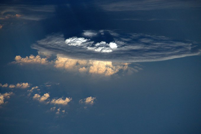
The flat top in both photos is the signature anvil when the storm reaches so high, it butts up against the stratosphere and temperature begins warming with altitude, essentially providing a ceiling and the clouds then spread out along this invisible barrier.
However, the bubbles in the middle are where the updrafts are so intense, they have enough momentum to burst into the stratosphere — another sign of a very strong storm.




 Photographer Finds Locations Of 1960s Postcards To See How They Look Today, And The Difference Is Unbelievable
  Hij zet 3 IKEA kastjes tegen elkaar aan en maakt dit voor zijn vrouw…Wat een gaaf resultaat!!
  Scientists Discover 512-Year-Old Shark, Which Would Be The Oldest Living Vertebrate On The Planet
  Hus til salg er kun 22 kvadratmeter – men vent til du ser det indvendigt
  Superknepet – så blir snuskiga ugnsformen som ny igen!
  Meteorite That Recently Fell in Somalia Turns Out to Contain Two Minerals Never Before Seen on Earth
  Nearly Frozen Waves Captured On Camera By Nantucket Photographer
  It’s Official: Astronomers Have Discovered another Earth